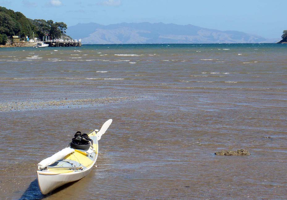
I started this trip at Herne Bay Beach, near home. A fresh SW wind allowed me to hoist my sail immediately. And I made fast time outward through the harbour in spite of the incoming tide.
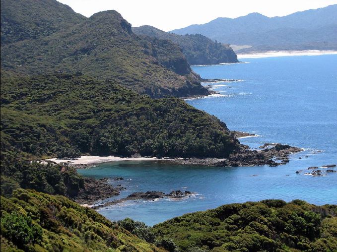
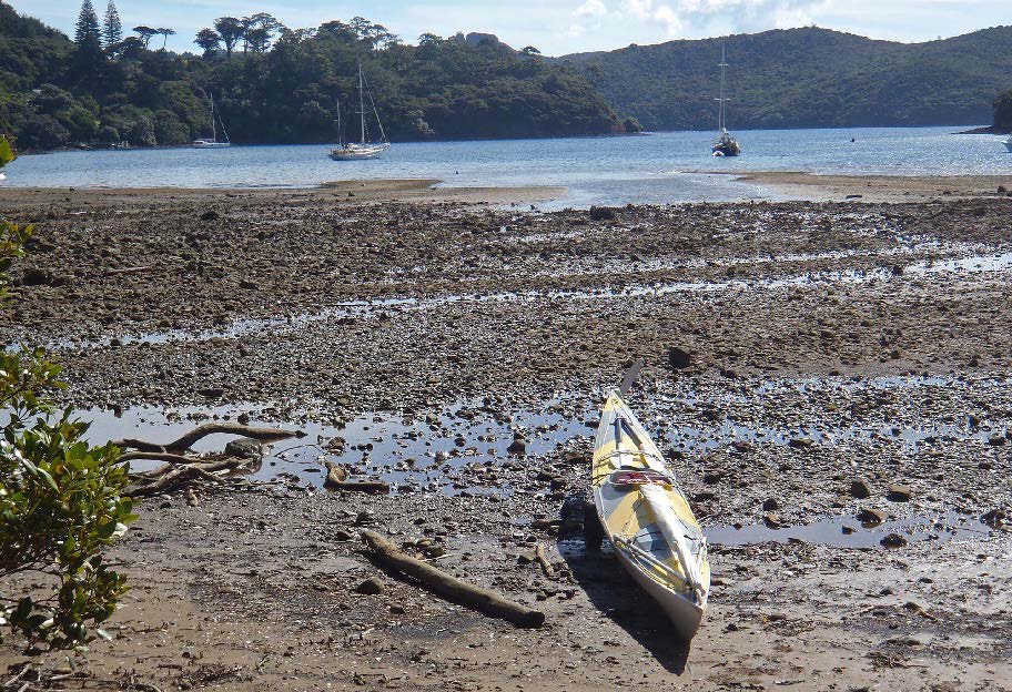
As the wind strengthened in the afternoon, the sail began to get over-powered. Off Beachlands I stowed it, turned downwind, and in a steep, short sea paddled across to Rocky Bay on Waiheke. This photo below looks north towards Motuihe Island.
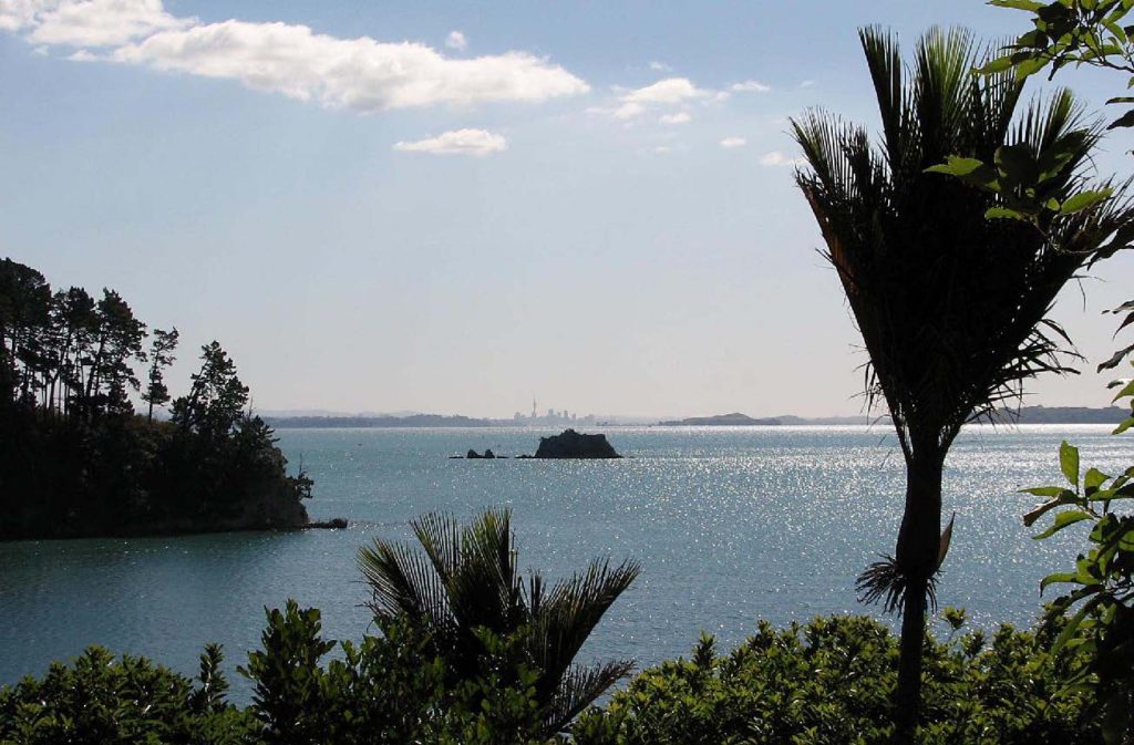
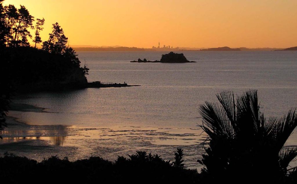
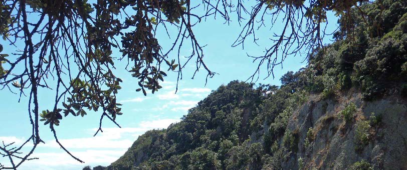
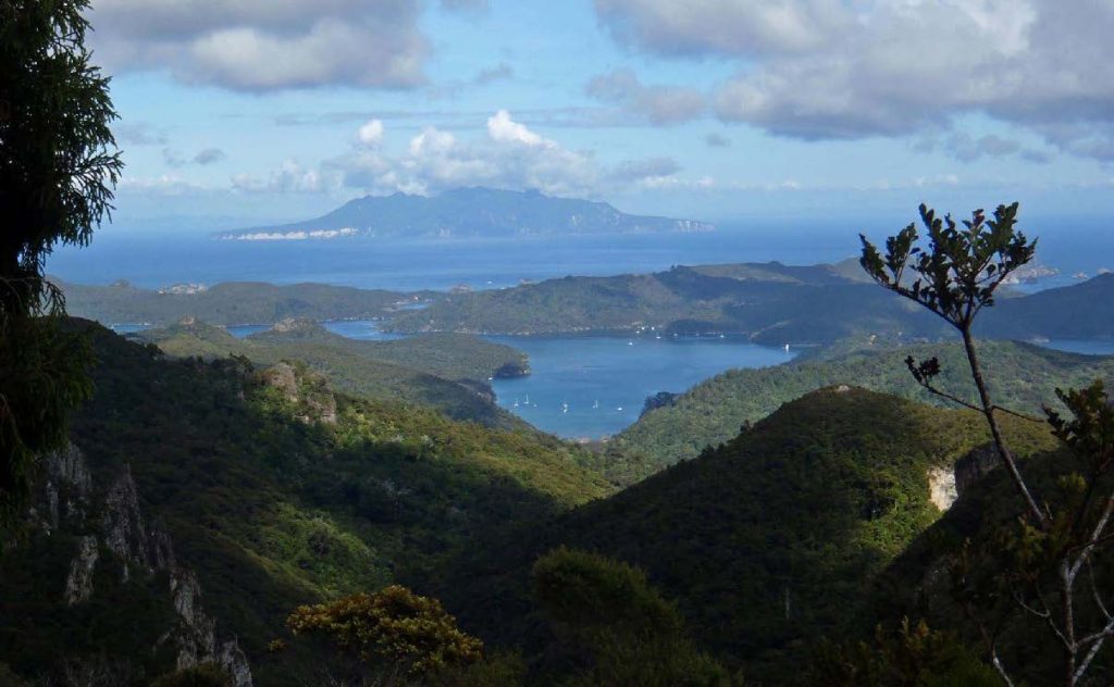
Strong SW winds were forecast for the next day so I opted to have a day ashore at the Whakanewha Regional Park in Rocky Bay. From the old pa site above the campground there were pleasant views back towards the city.
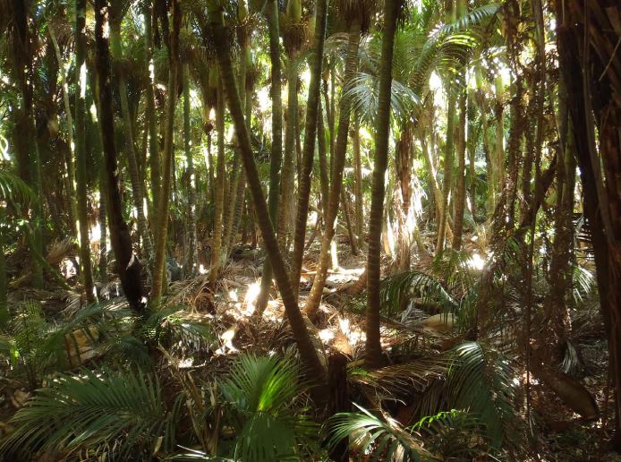
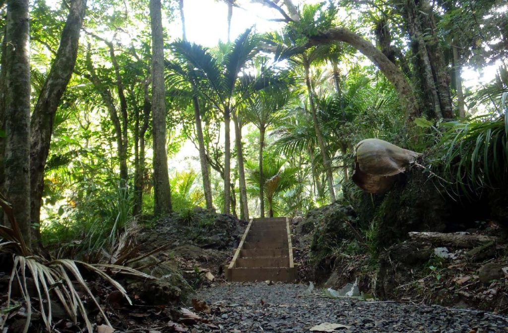
Some attractive bush walks have been developed in the park; this one led up a dry valley through glades of nikau palms.
Rocky Bay looks west, and on both nights there were fine sunsets.
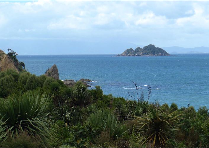
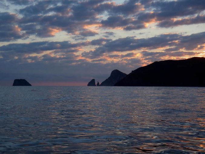
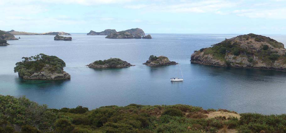
On this trip I was keen to visit Tarahiki Island, which sits in the Firth of Thames east of Pakatoa. This photo of Tarahiki was taken several weeks earlier, (from Rotoroa Island).
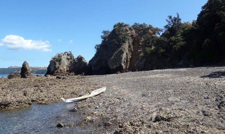
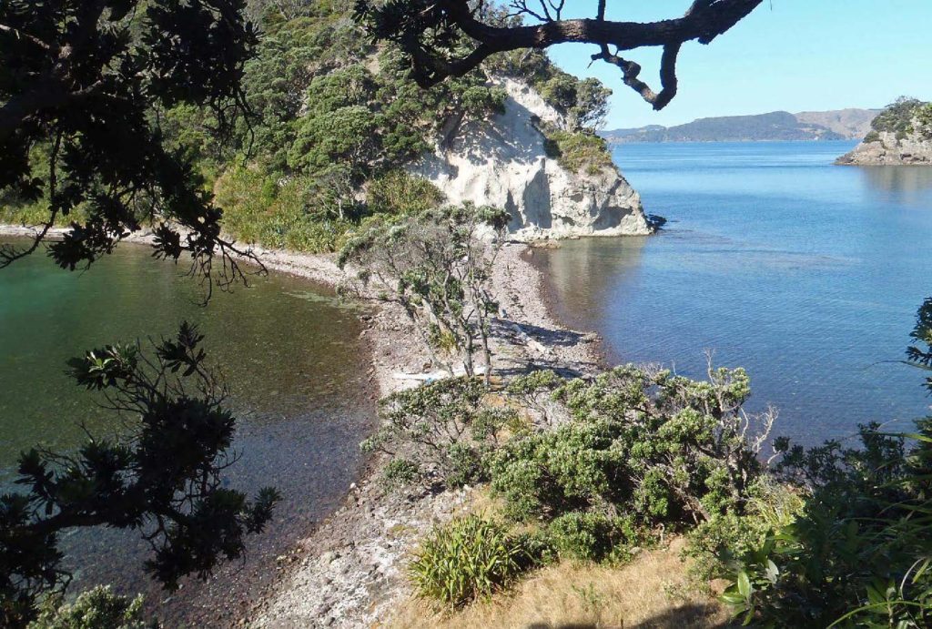
I found that there were two shingle beaches on Tarahiki. This one on the western side would give an easy landing at high or mid-tide, but at low water there was only a tiny clearing among oyster-covered rocks.
The same applies to the beach on the northern side. This one would be sheltered in SW winds.
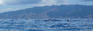
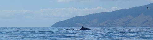
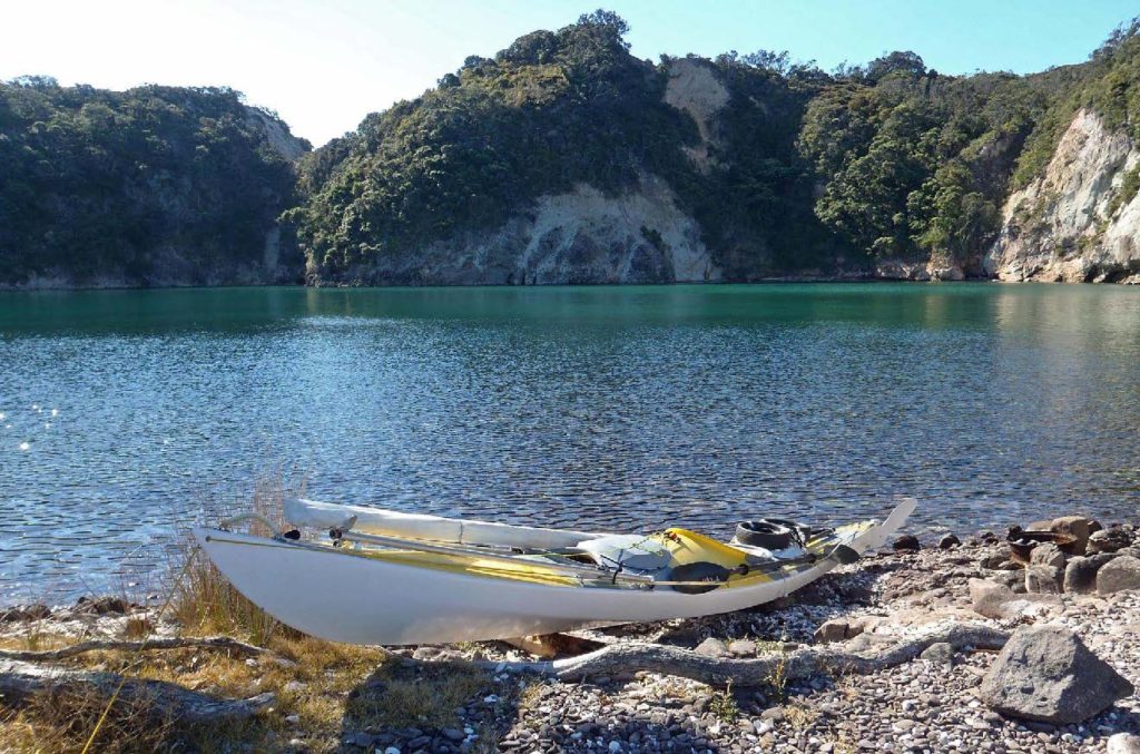
I had lunch on Tarahiki and afterwards crossed the Firth to Motukahaua Island (“Happy Jack”). The 20km-crossing took about 3.5hr in calm conditions.
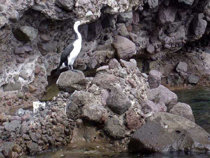
On the way across I met two Brydes whales feeding on schools of small fish near the surface, (along with the usual kahawhai, gannets and terns).
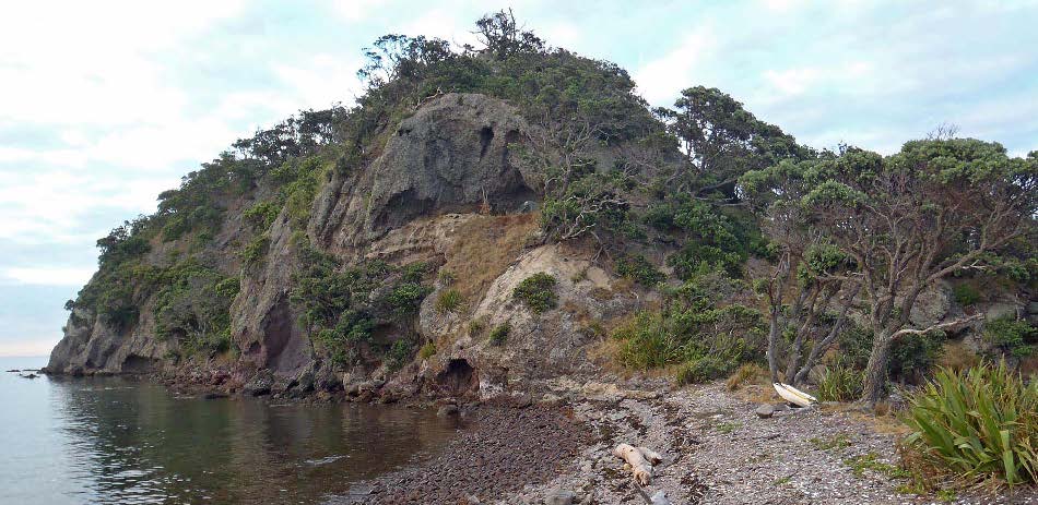
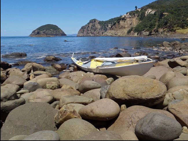
Happy Jack is well known for the south-facing cove which provides a sheltered anchorage. The eastern arm of the cove is a boulder spit which joins a small headland to the main island. This photo looks onto the boulder spit from the headland.
Ashore on the spit. To my surprise I found campers there already; five Korean fisherman who had been dropped off for three days of rock-fishing. The were friendly but irresponsible (lighting a large driftwood fire in the evening despite the island being tinder-dry).
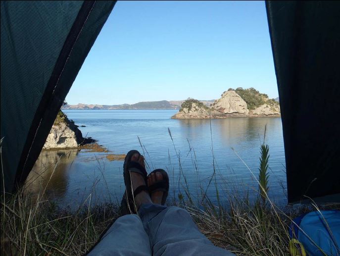
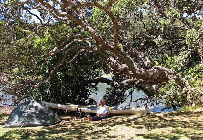
The Koreans had an uncomfortable spot among the boulders, but I found a much better one on the floor of a cave half-way up the southern headland. My tent is arrowed.
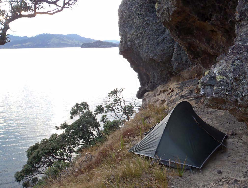
Not many campsites offer a view like this from the tent doorway!
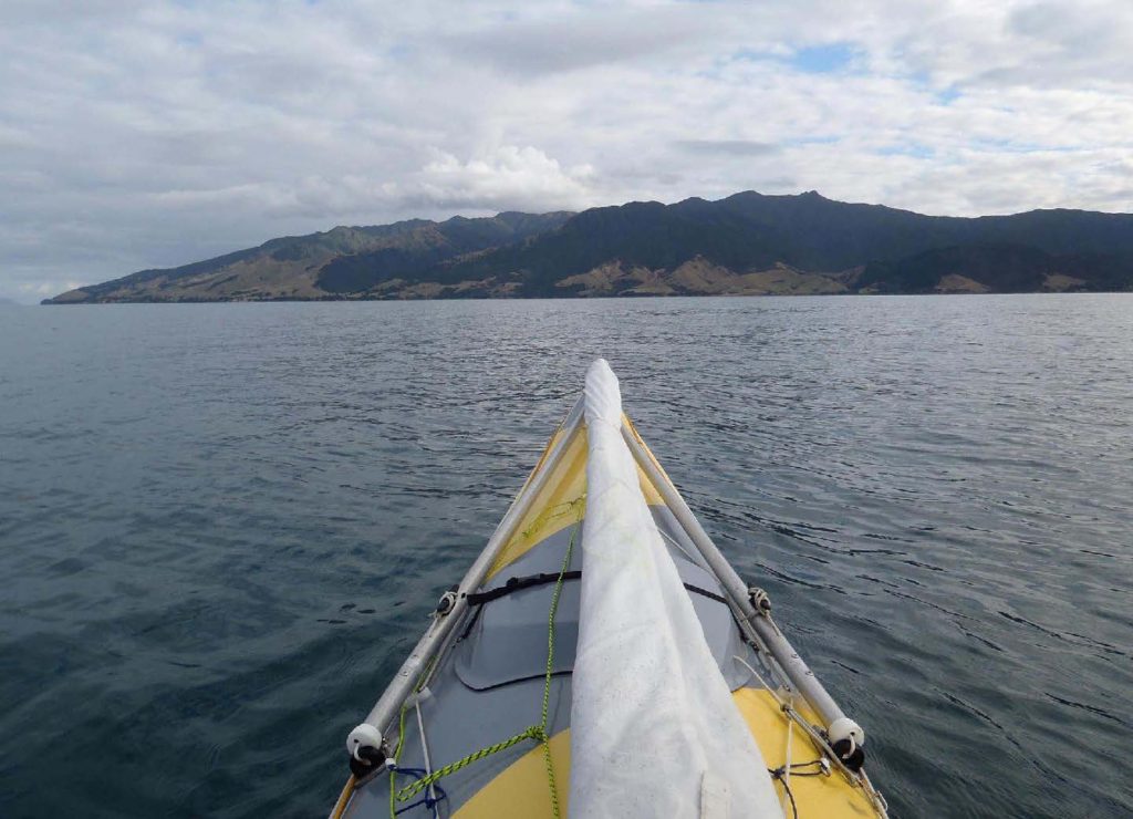
By now the North Island was covered by a large anticyclone. In a flat calm I crossed to the Coromandel Peninsula north of Colville Bay next morning.
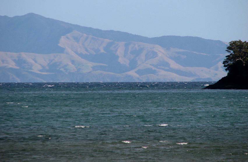
The view back towards Waiheke Island.
I reached the DOC campground at Port Jackson in the early afternoon, in time to walk up to the hilltop west of the bay. This gave a great view out across the Colville Channel towards Cape Barrier.
Leaving Port Jackson at sunrise next morning. The Colville Channel, even in calm conditions, demands respect and an early start is the best policy.
Tidal currents set strongly through the channel; the flood tide westwards into the Hauraki Gulf, and the ebb eastwards. I had the ebb running all morning, so although I wanted to make landfall east of Tryphena, I steered a course well to the west and allowed for the current to carry me down.
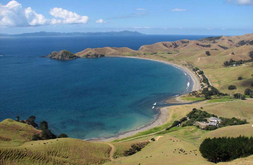
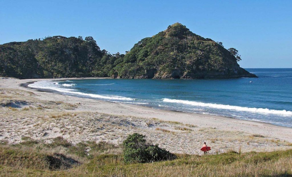
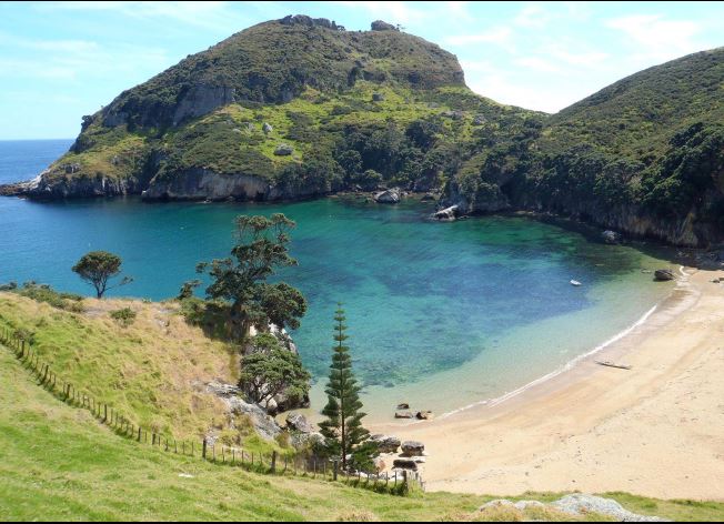
Ashore at beautiful Sandy Bay, east of Tryphena, about 3hr (21km) out from Port Jackson. I found a shady spot to make coffee, feeling very pleased to have made the crossing so easily. “Sandy Bay” is not as unimaginative a name as it seems, since other bays nearby are all stony.
Once around Cape Barrier there is only one possible landing before the long stretch of cliffs leading to Medlands Beach; the landing is at Rosalie Bay. However at low tide the bay is all boulders. I slid my boat ashore over pieces of driftwood to spare her bottom. Poor old girl, she deserves better treatment!
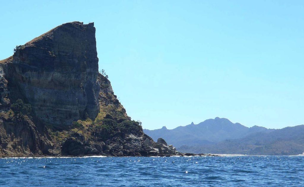
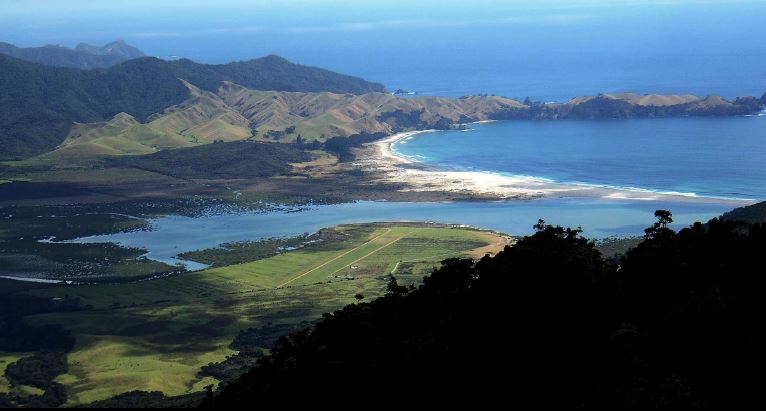
Last time I paddled this coast (2005) we struggled up to Medlands against a fresh headwind; but today conditions were much easier. This is the distinctive southern headland of Medlands Beach.
There is a pleasant DOC campground at the southern end of the beach, (arrowed), with a hard-packed sandy road leading to it from the beach. This photo was taken……….
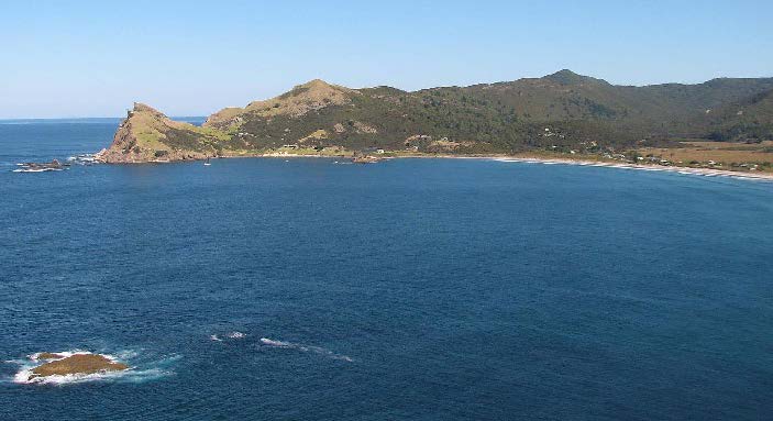
……… from the pa site at the northern end of the beach. The site is on a headland which tucks around to shelter that end of the bay. There is always a calm landing here, even when surf affects the rest of the beach.
Heading north next morning. The beach in the distance, centre, is Palmers Beach, north of Kaitoke.
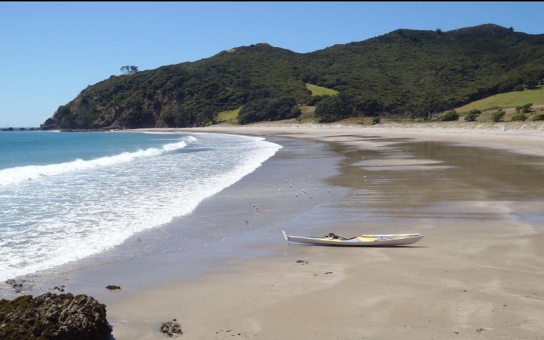
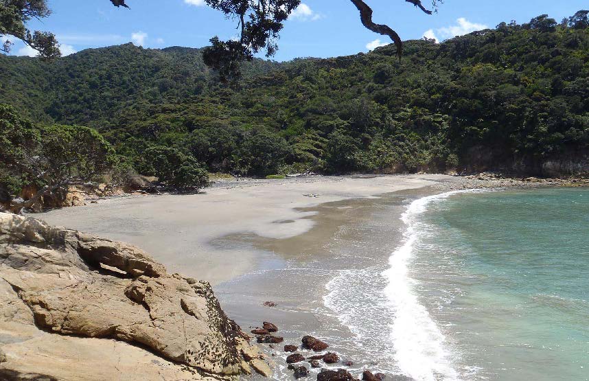
I landed through surf at Awana to check out the DOC campground there. It was useless; a hot and windless expanse of grass with no shade at all, (and 300 metres up a shallow estuary to reach it). Fortunately, only an hour further north is Harataonga…………..
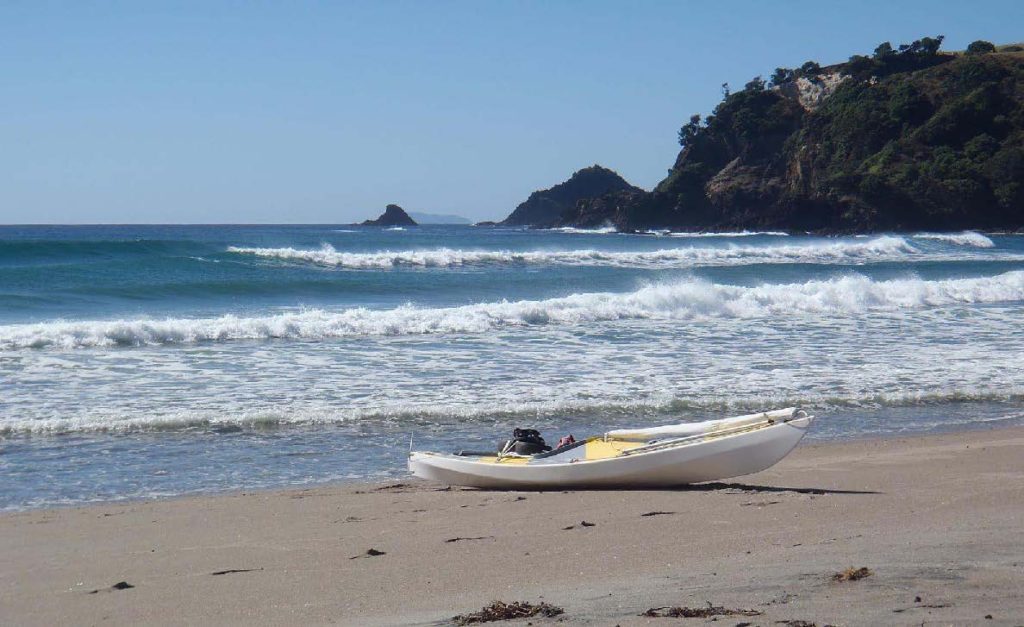
……….. where the beach is partly protected from the swell by islands offshore, so the surf is much smaller
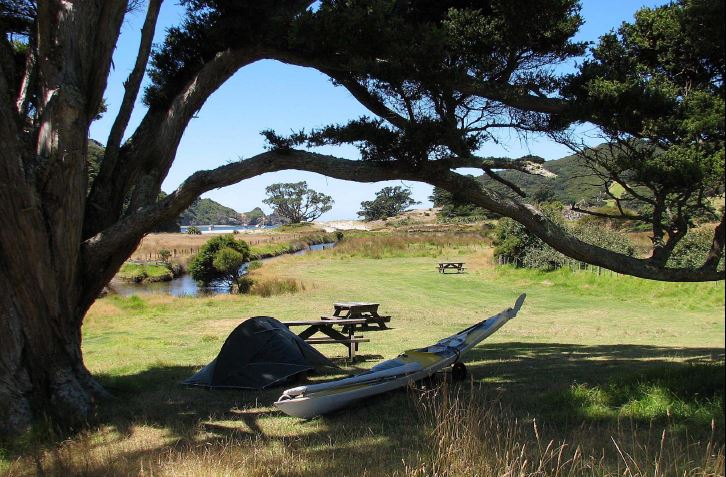
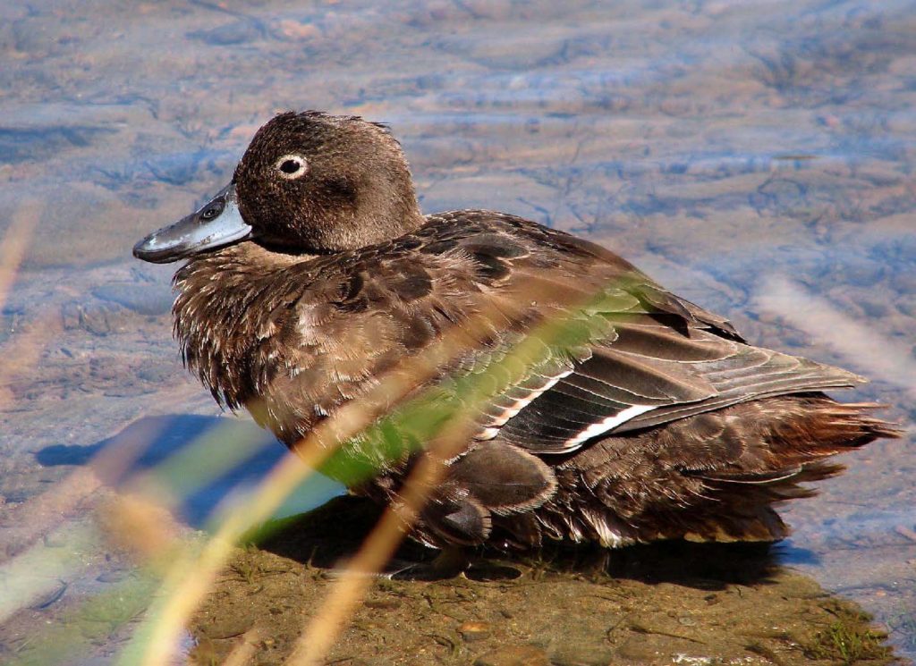
The DOC campground at Harataonga is reached by paddling up the creek. This is a tranquil and shady campsite, heaven for a kayaker in hot weather. It has a view of the sea, and Brown Teal in the creek for company.
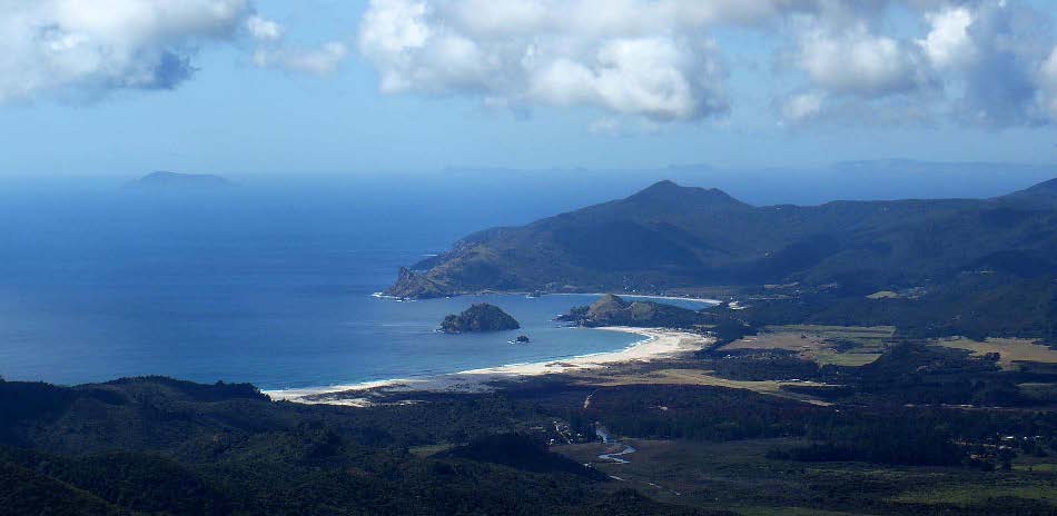
In the afternoon I walked the loop track to an old pa site above the beach. The view northward showed some interesting beaches, which I explored next morning on my way to Whangapoua.
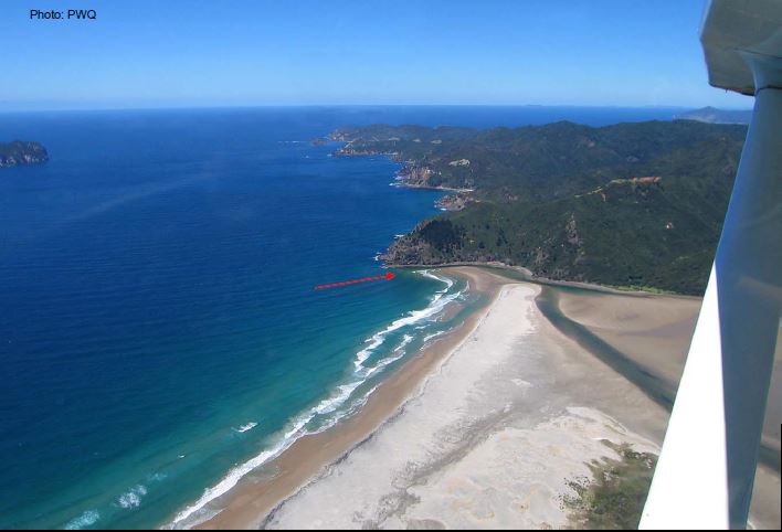
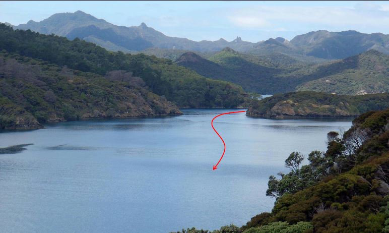
Whangapoua is an expansive white-sand beach with a large estuary behind it. The estuary has a narrow deep-water channel (arrowed) hard against the rocks of the southern headland. The channel is very hard to spot from seaward, but shows clearly in this aerial photo taken by Peter some years ago.
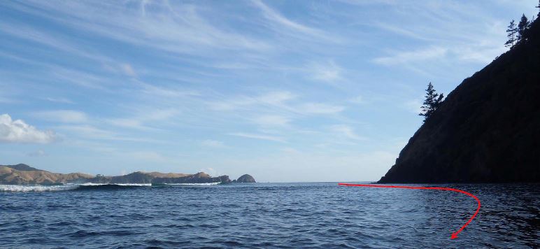
I entered the harbour just to check out the channel. It might break right across at low tide or in a heavy easterly swell.
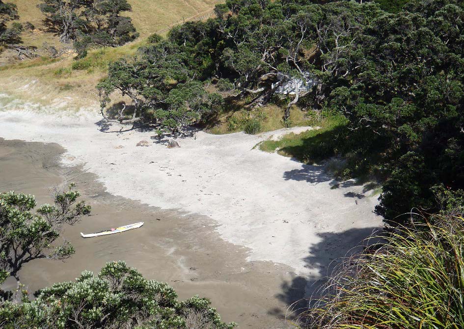
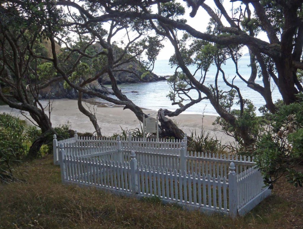
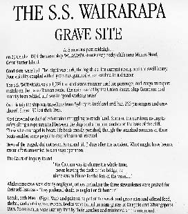
At the northern end of Whangapoua Beach, in a peaceful setting beneath pohutukawas, is a historic graveyard where victims of the SS Wairarapa shipwreck are buried.
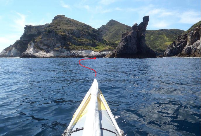
From Whangapoua I back-tracked out to the east to visit the cove on the N side of Arid Island
(Rakitu). The entrance to the cove is narrow and does not become obvious until the last minute.
It is a beautiful place. At night it will be crowded with boats seeking a peaceful anchorage, but it
empties out by day. The island is publicly owned and leased out for farming.
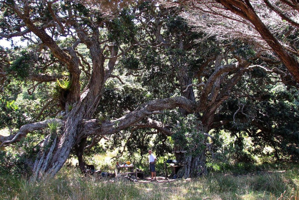
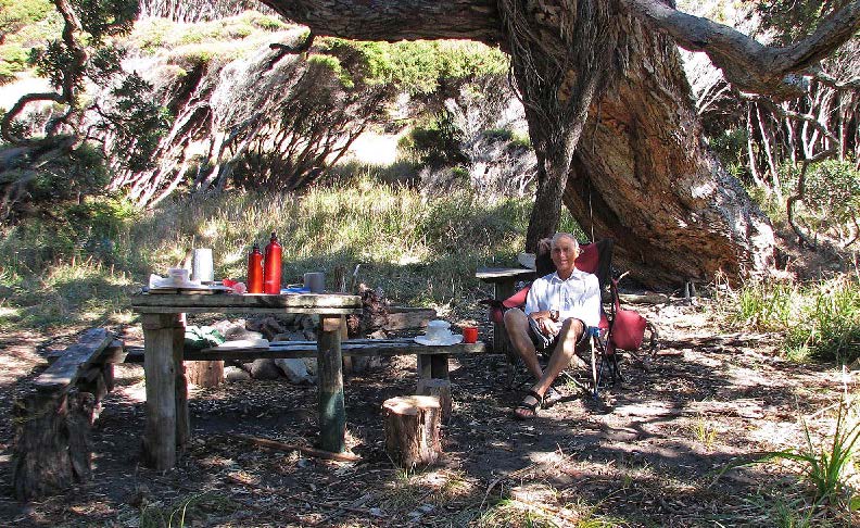
With the prospect of rounding the northern tip of Great Barrier tomorrow, I wanted to camp as near to Needles Pt as possible so I could get around in the early-morning calm. The best place is at Rangiwhakaea Bay, about 10km south of the Needles. So I ignored the DOC sign prohibiting camping there, and settled into the long-established campsite beneath two huge pohutukawas.
It is hard to imagine a more pleasant campsite than this one. It is well equipped with driftwood furniture, and even a cunningly-repaired folding camp-chair.
The salty kayaker in need of a wash can get it in the creek at one end of the beach.
On the way out to Needles Pt next morning, in ideal conditions.
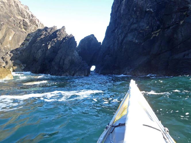
A narrow tunnel provides a shortcut for kayakers at Needles Pt, depending on how big the swell is within it. On our last trip in 2005 Mike Randal capsized inside this tunnel, so I suppose it could be named Randal’s Tunnel.
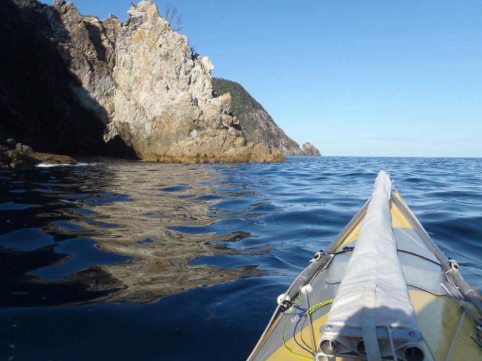
Once through the tunnel I found conditions flat calm on the western side of the island.
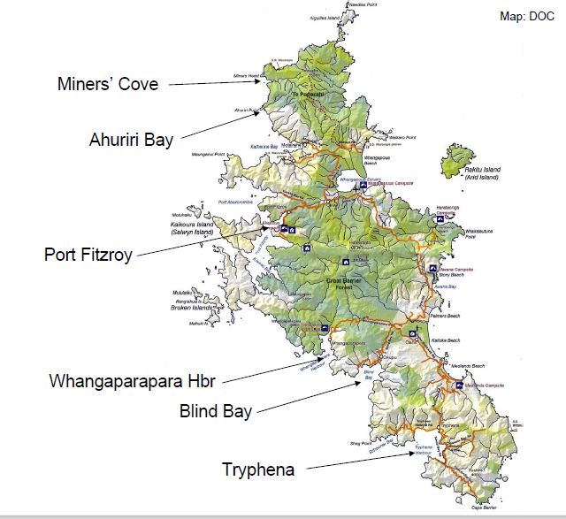
Miners’ Cove is about 7km southwest of Needles Pt. On past trips we have camped among the flax on the grassy flat behind the beach; but this time, when I stopped here for morning tea, I found a much better, and shady, spot beneath the manuka trees at the right-hand edge of the photo.
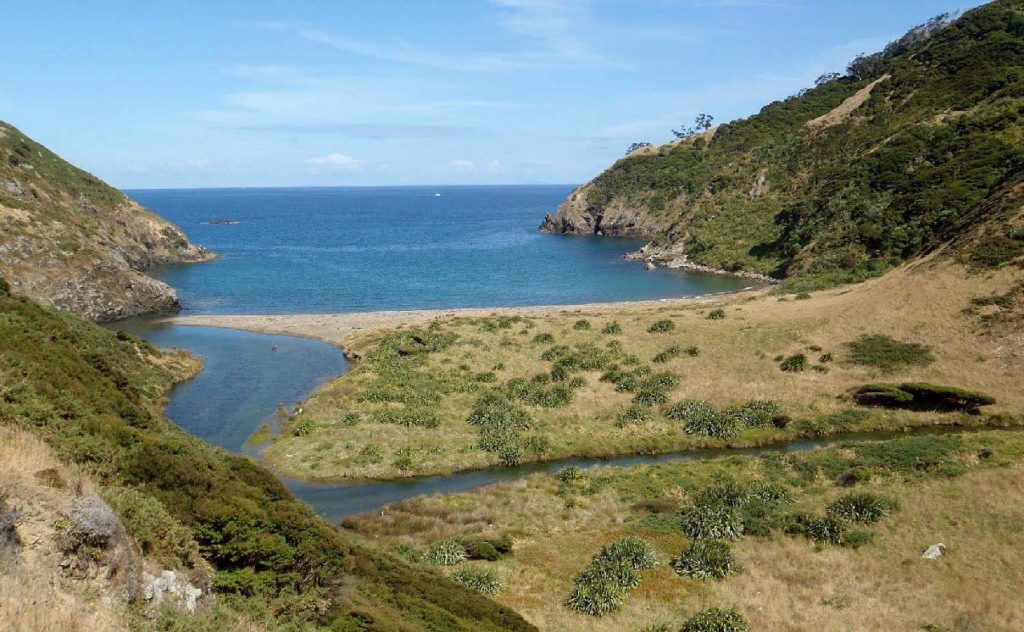
A few kilometres south of Miners’ Cove is beautiful Ahuriri Bay, with a pa site on its western headland.
There is a potential campsite beneath the pohutukawas in the valley behind the beach, but gear would have to be carried there through thick kikuyu grass.
After a long day of sun and calm seas, I reached the DOC campground at Akapoua Bay in Port Fitzroy. This beach is pleasant at high tide, but horrible at low tide: an expanse of sandy mud covered in rocks and oysters.
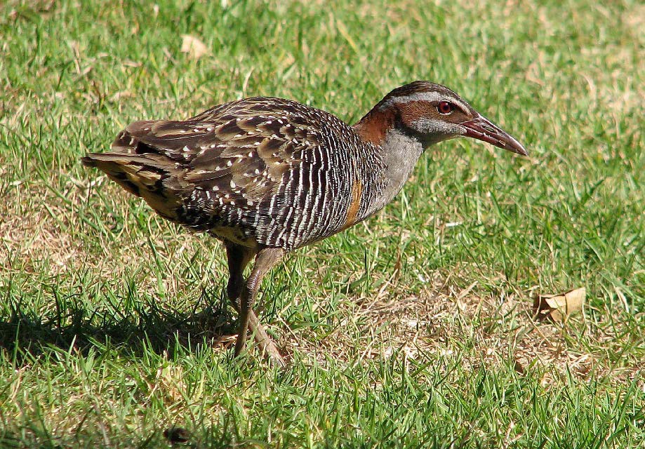
In compensation, some very interesting birds roam the campsite. This is a Banded Rail, now rare on the mainland; but there were several families at Akapoua Bay. I tempted the birds with muesli in order to get this photo.
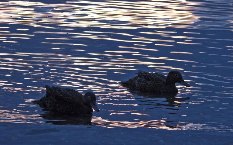
Brown Teal in the shallows at the edge of the bay, near sunset.
I took a day off to climb Mt Hobson from Port Fitzroy. In recent years DOC have upgraded the track so that the trip is much faster and easier than it used to be.
From the summit (or close to it) there are extensive views across Port Fitzroy and Little Barrier to the west…………..
………. Whangapoua Estuary to the north……….
………. and Medlands Beach to the southeast.
After two nights at Akapoua Bay I paddled south, leaving Port Fitzroy through Man of War Passage. This and some of the following photos were taken a few days later, but I have blended them together so they are in geographical sequence (rather than correct time sequence).
Islands of the Grey Group in the foreground; and in the distance the Broken Islands.
All of these islands are made of conglomerate, so they must have been formed on the submarine slopes of some ancient land.
From a cove in Bowling Alley Bay I scrambled up onto a bare hilltop to the west for the view. The Broken Islands are in the middle distance, with Little Barrier beyond.
The Junction Islands to the south of my hilltop.
The south-westerly became fresh as I paddled to Whangaparapara Harbour, so I was pleased to get out of lumpy seas later in the afternoon.
There is a delightful DOC campground at “The Green” near the head of Whangaparapara Harbour. It is tucked in behind a small headland, so that even strong SW winds are scarcely felt. Add to that shade, no road access, few other campers, and plenty of good walks nearby…… I was a happy
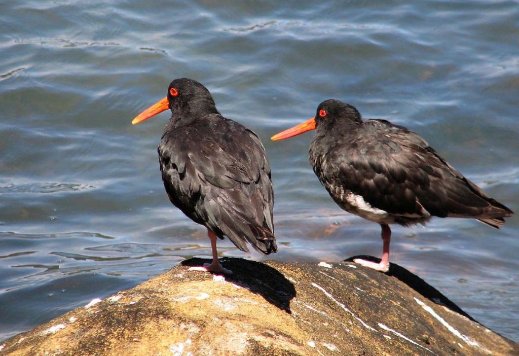
Oyster-catchers roosting during high tide at my beach.
For the next three days the view out of the harbour (with a telephoto lens) each morning showed a rough sea with plenty of white-caps, so I went walking instead of paddling.
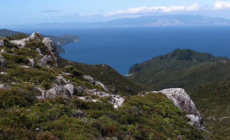
One of my walks was onto the summit of Te Ahumata, east of Whangaparapara Harbour. There were fine views across the Colville Channel towards Port Jackson.
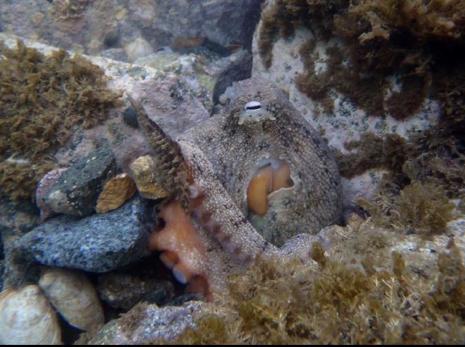
When the wind finally relented, I paddled south towards Tryphena. On the way I stopped briefly at the Whangaparapara Wharf to get rid of my rubbish into the bin there; and met this friendly octopus who evidently lived in a hole beneath the concrete slabs of the boat ramp. It’s surprising what nice people you meet on the way to the rubbish dump!
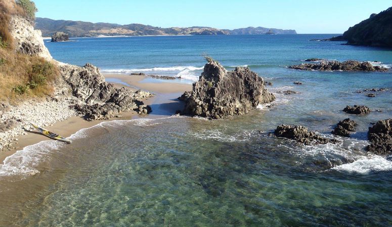
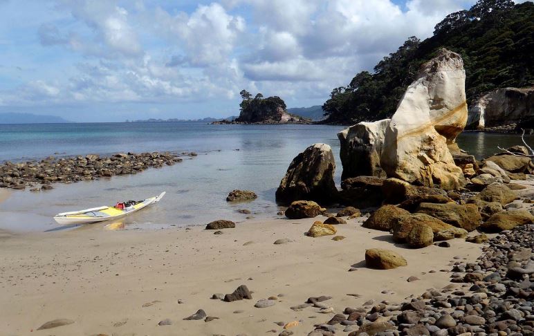
On the way south I explored Blind Bay. There are two shallow sandy beaches at the head of the bay, but all the small beaches on the N and S arms of the bay are stony. This is the only exception, a tiny cove just N of Shag Pt.
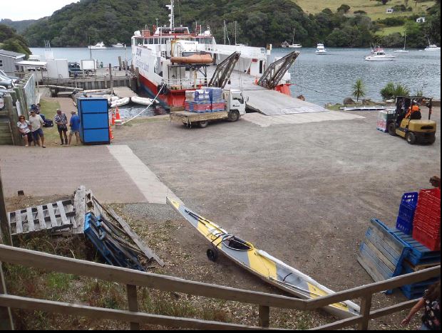
I expected to be able to catch the Sealink ferry home to Auckland from Tryphena; but it happened that the next sailing from there was classified as a “Dangerous Goods” sailing, and therefore only a few passengers could be carried. So after a night camped at the “Stray Possum” lodge in Tryphena, and with SE winds forecast, I opted to paddle back up the coast to Port Fitzroy and catch the ferry there on the following day. An easy trip home, and the end of another interesting trip!
By Colin Quilter